
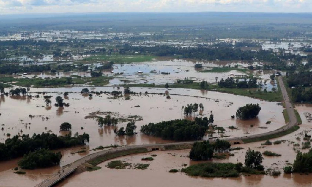
A weather pattern developing thousands of kilometres away in the Pacific Ocean could soon reshape Kenya's weather, with forecasters warning that El Niño is strengthening and the country's October-to-December rains could be wetter than normal.
The development matters because the October-December period is Kenya's main short-rains season. If the current forecast holds, some parts of the country could receive significantly more rain than usual, bringing relief to farmers and water-stressed communities but also increasing the risk of floods, landslides and other weather-related disruptions.
The World Meteorological Organisation (WMO) says El Niño has already developed in the tropical Pacific and is expected to strengthen rapidly. Its July forecast pointed to a strong event developing between July and September, with the potential for more extreme weather in several parts of the world.
But an important distinction is often lost in the headlines: El Niño does not mean that every part of Kenya will simply get more rain.

The eventual impact depends on other climate systems, including conditions in the Indian Ocean, as well as local geography and the timing and intensity of individual storms.
So, what exactly is El Niño?
El Niño is part of a natural climate cycle known as the El Niño-Southern Oscillation (ENSO).
It begins when surface waters in the central and eastern tropical Pacific become unusually warm.
That may sound like a distant problem for a country such as Kenya. It is not.
The Pacific Ocean covers a vast area, and changes in its temperature can alter atmospheric circulation. Those changes affect the movement of moisture, winds and rising air around the world.
The result can be a shift in normal rainfall and temperature patterns thousands of kilometres from where the ocean initially warmed.
The WMO describes ENSO as one of the world's major natural drivers of climate variability. El Niño typically develops every two to seven years and can last for several months.
Why does Kenya care about a warm Pacific?
East Africa is one of the regions where El Niño can have a pronounced effect on rainfall.
During an El Niño event, changes in atmospheric circulation can favour increased moisture and rainfall over parts of East Africa, particularly during the October-December season.
That is why Kenya's meteorological authorities are watching the Pacific closely as the country approaches the short-rains season.
The WMO's latest forecasts provide a strong signal that the 2026 El Niño could become unusually powerful. In July, its multi-model forecast indicated that the event could reach a seasonal average of about 2°C above normal in the Niño 3.4 region during July-September.
The US National Oceanic and Atmospheric Administration also reported in July that El Niño had strengthened, with the weekly Niño 3.4 index reaching 1.2°C above normal. It gave a 97 per cent probability that El Niño would continue through early spring 2027.
That does not translate directly into a specific amount of rainfall for Kenya. Rather, it increases the likelihood that the climate pattern will influence weather systems affecting the region.
The Indian Ocean is another piece of the puzzle
The Pacific is only part of the story.
Kenya sits next to the Indian Ocean, so temperatures in that ocean also influence the country's rainfall.
One important factor is the Indian Ocean Dipole (IOD). It describes differences in sea-surface temperatures between the western and eastern parts of the Indian Ocean.
Forecasts for 2026 indicate that the IOD could move into a positive phase as El Niño strengthens. The WMO's July outlook put the seasonal IOD value at about +0.6°C for July-September.
When major climate drivers line up in a way that favours moisture over East Africa, the chances of heavy rainfall can increase.
But that still does not mean every county will experience the same conditions.
Kenya's mountains, lowlands, coast and arid regions respond differently to large weather systems. Rainfall can also be highly localised, with one area receiving a damaging downpour while another nearby receives much less.
That is why seasonal forecasts are probabilities, not guarantees.
What could the rains mean for Kenya?
For farmers, the prospect of better October-December rains could be welcome news.
Adequate rainfall could improve soil moisture, support crop growth, replenish water sources and restore pasture in areas affected by dry conditions.
But too much rain, particularly when it falls within a short period, can quickly turn into a hazard.
Urban areas face flooding when drainage systems cannot handle intense downpours. Rivers can rise rapidly. Saturated slopes can become vulnerable to landslides.
Roads and bridges can also be damaged, while farms may suffer waterlogging and crop losses.
The same rain that helps replenish a reservoir can therefore create serious problems if it arrives too intensely or in the wrong place.
The WMO has warned that the developing El Niño is increasing the likelihood of weather extremes, including heavy rainfall in some regions and drought in others.
Why timing will matter
Kenya's weather authorities will continue refining the forecast as October approaches.
That is important because the strength of El Niño alone cannot tell Kenyans exactly when a particular storm will occur or how much rain a specific county will receive.
The Kenya Meteorological Department's seasonal forecasting system combines global and regional climate drivers to produce more localised outlooks for sectors including agriculture, water, health, transport and disaster management.
For communities, the most useful information will therefore be the shorter-range forecasts issued as the season gets closer.
Farmers may need to plan planting around the expected onset of rains. County governments may need to inspect drainage and flood-prone areas. Residents in landslide-prone zones should pay attention to warnings after prolonged or intense rainfall.
And for households in areas that have recently experienced water shortages, the expected rains could provide much-needed relief.
Not simply a story of 'more rain'
The temptation is to reduce the 2026 El Niño story to one simple prediction: Kenya will get heavy rains.
The reality is more complicated.
El Niño is a global climate signal. Its effects are filtered through the Indian Ocean, regional weather systems and Kenya's varied terrain.
What is clear is that the signal is strengthening.
The WMO says El Niño is expected to continue developing through the second half of 2026, while global forecasters are watching closely for its peak, which typically occurs between November and February.
For Kenya, that puts the coming months firmly in the watch-and-prepare category.
The rains could bring water, pasture and better farming conditions.
But if the forecast turns into intense rainfall in vulnerable areas, the same weather system could also test the country's roads, drainage networks, farms and emergency services.
The real question is no longer whether El Niño is developing. It is how Kenya prepares for what comes next.
You may also like
Category: News
About the Author
Maureen Onyango is a journalist passionate about storytelling, life coaching and spiritual lessons. She studied at the Kenya Institute of Management and enjoys telling stories that inform, inspire and empower communities.
 Facebook
 Twitter / X
 WhatsApp
 LinkedIn
 Telegram
 Reddit